News Summary
Fort Pierce, FL is currently under a Tropical Storm Watch as Tropical Depression Nine approaches the region. The storm is expected to strengthen over the weekend, bringing gusty winds, rough surf, and heavy rain to coastal areas. Schools in the St. Lucie Public Schools district will remain open while officials monitor the situation. Residents are urged to prepare for potential flooding, high surf, and rip currents as the storm’s impacts could affect local communities and beyond.
Fort Pierce, FL – The Treasure Coast is currently under a Tropical Storm Watch as Tropical Depression Nine approaches South Florida. The storm is expected to strengthen over the weekend, with forecasts indicating gusty winds, rough surf, and heavy rain could affect coastal areas starting late Sunday into Monday.
Tropical Storm Watches have been issued for Coastal Martin, St. Lucie, and Indian River counties. As of now, schools in the St. Lucie Public Schools district plan to operate as normal for the upcoming week, without any announced closures. District officials are closely monitoring the situation and remain in contact with the St. Lucie County Emergency Operations Center to ensure that they are prepared for any changes in conditions.
Current Weather Conditions and Predictions
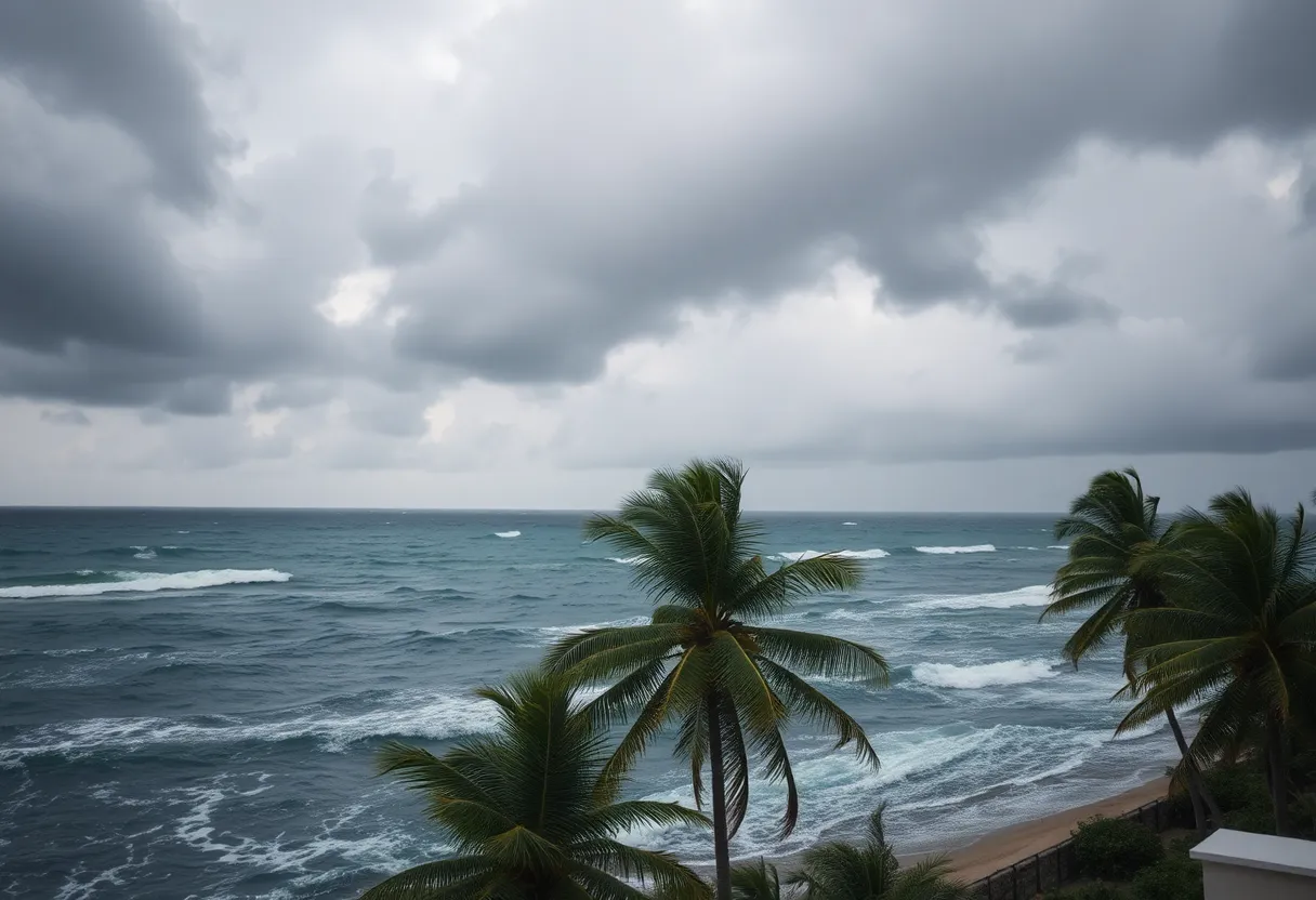
The National Hurricane Center predicts that Tropical Depression Nine, which formed between the central Bahamas and eastern Cuba, will move northwest across the Bahamas this weekend while tracking parallel to Florida’s east coast. Although the storm’s center is expected to remain offshore, residents can anticipate significant impacts, such as gusty winds, potential rip currents, and heavy rainfall affecting local communities.
As of the latest reports from NOAA Hurricane Hunter aircraft, the storm has developed a more defined circulation with sustained winds nearing 35 mph. Forecasters warn that the storm could strengthen into a tropical storm or even a hurricane as it approaches South Florida.
Impending Impacts
Heavy rainfall is projected for several regions, including Hispaniola, eastern Cuba, Jamaica, and the Bahamas, with flash flooding and mudslides likely in mountainous areas. In South Florida, rainfall totals are expected to range from 1 to 3 inches, with some areas potentially receiving over 4 inches. These conditions might also lead to hazardous situations in parts of Georgia, the Carolinas, and Virginia by early next week.
Local authorities have alerted residents about the potential for high surf and boating hazards. Breaking waves are anticipated to reach heights between 6 to 8 feet, and a high risk of rip currents is expected along the coast, particularly from Sunday into Monday. It is advised that residents review their hurricane readiness plans and stay vigilant, regardless of the storm’s current trajectory offshore.
Monitor for Updates
Families in the St. Lucie Public Schools district are encouraged to stay informed by checking the district’s website, following their social media accounts, and staying updated through local news channels. The district has stated that before- and after-school programs are expected to continue as scheduled next week, reflecting their current assessment of the situation.
Background Context
Tropical Depression Nine formed on Saturday morning, demonstrating the typical development patterns observed when tropical systems emerge in the Caribbean region. The likelihood of the storm stalling off the Southeast coast in the coming week presents potential worsening consequences for areas in the Carolinas and Mid-Atlantic if it persists and intensifies.
As the weekend approaches, community engagement and preparedness measures will be critical for mitigating the impact of Tropical Depression Nine. Residents are urged to heed warnings, prepare their homes, and seek necessary supplies to weather any expected conditions in the coming days.
Deeper Dive: News & Info About This Topic
HERE Resources
Cleveland’s Unusual Dry and Cool September Weather
Additional Resources
- WPTV: Schools Monitoring Tropical Storm Watch
- Wikipedia: Tropical storm
- WPBF: Florida Tropical Storm Watch
- Google Search: Tropical Storm Watch
- Boca Raton Tribune: Tropical Depression Forms
- Encyclopedia Britannica: Hurricane
- Florida Today: Tropical Storm Watch Issued
- Google News: Tropical Depression Nine