News Summary
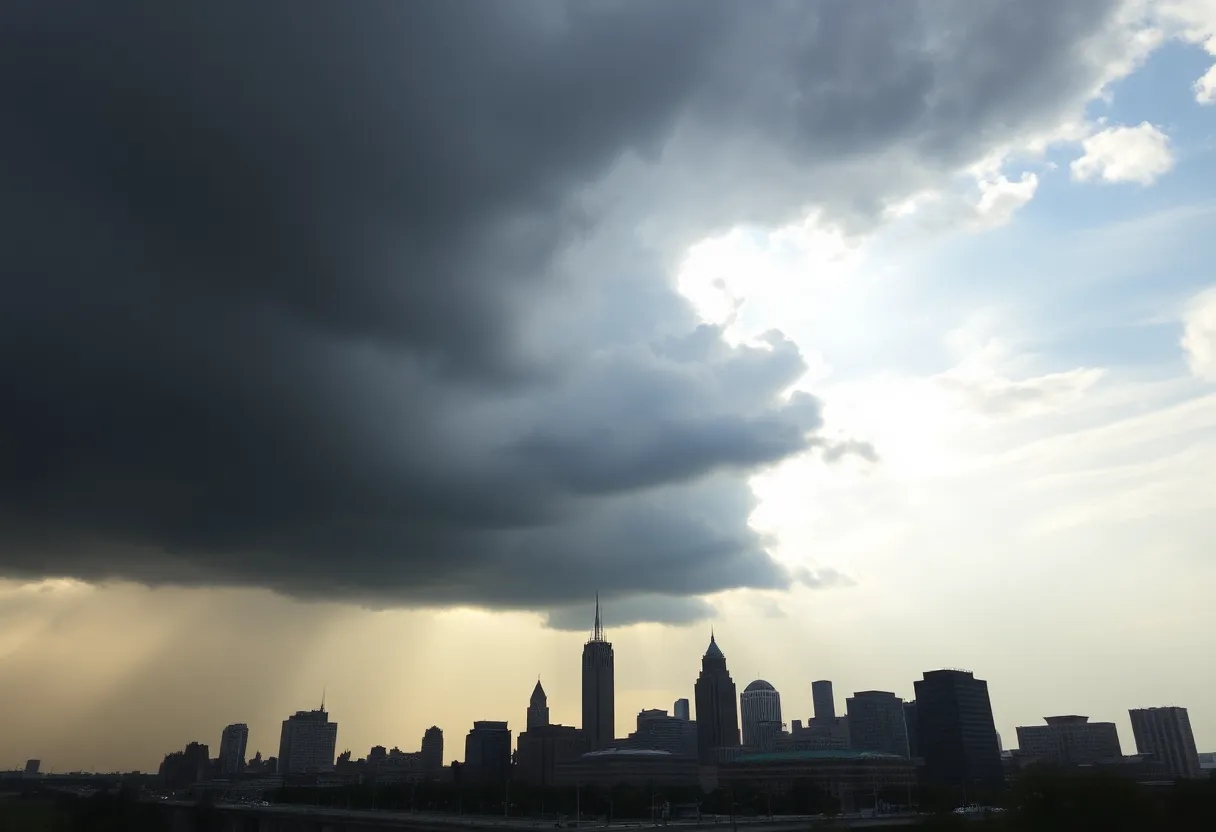
Cleveland is preparing for humid conditions and possible storms over the weekend due to a low pressure system and impacts from a powerful East Coast storm. Residents can expect warm temperatures with increasing clouds and scattered showers, particularly to the east. While severe weather risks have decreased, gusty winds and heavy rain may occur tonight, leading to localized flooding. Relief from the humidity is expected as high-pressure returns next week, but another heat wave could emerge Wednesday, with temperatures rising significantly before another cold front arrives.
Cleveland is bracing for humid conditions and potential storms over the upcoming weekend as a low pressure system is set to move through the area. This weather pattern will be compounded by a powerful storm on the East Coast that is expected to influence local weather from Saturday through Sunday.
Residents can anticipate warm temperatures today with a good amount of sunshine, reaching highs in the upper 60s. As evening approaches, clouds will increase, and the temperature will remain warmer, staying in the 70s. Tomorrow, there is a risk of scattered showers, particularly to the east of Cleveland, with precipitation chances increasing as the day progresses.
Sunday’s forecast suggests a mix of sun and clouds, accompanied by the possibility of isolated afternoon showers. The likelihood of rain will again be greater in areas east of Cleveland. While the threat of severe weather has diminished, tonight could still bring some storms capable of gusty winds and heavy rain, leading to localized flooding and high-water issues. Storm activity is expected to wane after midnight, although a few isolated storms may linger overnight.
On Sunday, a cold front will approach northern Ohio, increasing cloud cover and introducing the likelihood of scattered showers and storms, mainly during the morning hours. Humidity levels will remain elevated throughout the day but are expected to drop in the evening as high-pressure builds in the region. In terms of temperatures, Cleveland can expect highs around 80 degrees on Monday and Tuesday, with clear skies allowing plenty of sunshine.
As the week progresses, another heat wave is anticipated to start on Wednesday. Tuesday will see the arrival of a warm front that brings back humid conditions, likely resulting in showers and thunderstorms, particularly south and east of a line from Marion to Akron. Expect temperatures on Tuesday to reach the low to mid 80s, with rain coverage becoming more widespread Tuesday night as a cold front moves through. This front will taper off precipitation by Wednesday morning and subsequently deliver cooler air, with expected highs in the mid to upper 70s.
Following this period of instability, high-pressure systems will likely provide dry and sunny conditions from Wednesday night through Friday night. However, another shift in the weather is forecasted for Saturday, when a cold front may bring renewed chances for showers and thunderstorms. Saturday is predicted to be the warmest day of the week, with highs projected in the mid to upper 80s.
As temperatures drop after the weekend, highs will decrease into the low to mid 70s on Sunday and Monday. Overnight lows will also cool, starting in the low 60s Saturday night and dropping to the 50s by Sunday night. Additionally, the potential for lake-effect rain exists on Monday in areas east of Cleveland due to cooler air moving over the warmer lake waters.
Cleveland residents are urged to stay informed on weather alerts and plan accordingly for potential storms throughout the weekend.
Deeper Dive: News & Info About This Topic
HERE Resources
Big Changes Ahead for Golf Balls: The 2025 Testing Extravaganza
Major Discounts Available in Amazon’s Prime Day Golf Sale
Pittsburgh Public Schools Responds to Potential Threat
Lockdown at Springville High School Following Gun Threat
Score Big Savings: Amazon’s Big Deal Days Sale on Golf Shoes!
Storm Amy Causes Devastation Across Ireland and Scotland
Cleveland to Enjoy Unseasonably Warm October Weekend
East Cleveland Faces Financial Crisis Amid Receivership Proposal
Cleveland Weather Update: Pleasant Autumn Ahead
Cleveland Kicks Off October with Noteworthy Events and Updates
Additional Resources
- Cleveland 19 News: Northeast Ohio Weather
- WKYC: Cleveland Weather Storm Chances
- News 5 Cleveland: Severe Storms Develop
- Fox 8: Strong Winds and Storms This Weekend
- Cleveland.com: Showers & Thunderstorms Forecast
- Wikipedia: Weather
- Google Search: Ohio Weather News
- Google Scholar: Weather Patterns
- Encyclopedia Britannica: Weather
- Google News: Cleveland Weather

Author: STAFF HERE CLEVELAND WRITER
The CLEVELAND STAFF WRITER represents the seasoned team at HERECleveland.com, your premier source for actionable local news and information in Cleveland, Cuyahoga County, and beyond, delivering "news you can use" with in-depth coverage of product reviews for personal and business needs, local business directories, politics, real estate trends, neighborhood insights, and state news impacting the region—backed by years of expert reporting and robust community input, including local press releases and business updates, while providing top reporting on high-profile events like the Rock and Roll Hall of Fame inductions, Cleveland International Film Festival, and holiday parades, alongside key organizations such as the Cleveland Clinic, Cleveland Orchestra, and Great Lakes Science Center, plus leading businesses in manufacturing and healthcare like Sherwin-Williams and University Hospitals, and as part of the broader HERE network including HEREDayton.com, offering comprehensive, credible insights into Ohio's vibrant landscape. HERE Cleveland HERE Dayton